About 465 kilometres of groomed trails can be found in Whitecourt and the club is always on a mission to improve the experience with more trails and excellent amenities. Over 500 volunteer hours have gone into improving trail signage on the trails, making them safer and easier to navigate than ever. And the newly-introduced smartphone-friendly trail map means a guide is always at your fingertips.
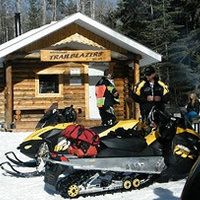
The main Eagle River Staging Area is located 10 kilometres northwest of Whitecourt on Highway 32 towards Swan Hills. Its amenities include a warm-up hut, fire-pit, outdoor bathroom, and a loading ramp.
Golden Triangle
The Golden Triangle is, as the name implies, a triangle of trails with Whitecourt to the south of Swan Hills in the northeast and Fox Creek in the northwest. The three communities maintain the trail and its many fully-stocked warm-up cabins. The trail is accessible from the main Eagle River staging area and from let-ins along Highways 32 and 43 where portions of the trail run parallel. Each trail offers beginner, intermediate and experienced riders scenic routes along rivers and in and out of treed areas; through hilly sections and along flat, wide-open patches. The total distance is 340 kilometres, and it takes about nine hours to complete the entire triangle.
Watch for the Carson Lake warm-up shelter northeast of the Eagle River staging area and for the Gundy rest area and warm-up shelter to the northwest towards Fox Creek. Both are fully equipped with bathrooms, firepits, stoves and picnic tables.
Summit Trail and warm-up shelter
Three trails converge at the Summit warm-up shelter—the Goodwin Lake, Manweiller and Summit Trails. The Goodwin Lake Trail is a 30 kilometre route that runs between the warm-up area and the far end of the Summit Trail past Goodwin Lake and along wide trails through somewhat hilly terrain that is still suitable for novice riders.
The 65-kilometre Manweiler Trail takes sledders from the warm-up shelter to the Gundy rest area, where it links up with the Golden Triangle on the way to Fox Creek. The Summit Trail leaves from Whitecourt and goes 31 kilometres to the warm-up area and 43 kilometres beyond to the Silver Summit ski hill.
Groat Creek Canyon Trail
The Groat Creek Canyon Trail can be accessed from a staging area on Higway 32 just southwest of Whitecourt. The highlight of the 15-kilometre Groat Creek Canyon Trail is the lookout over the canyon, which provides an awe-inspiring 200-foot view down toward the bottom of a creek valley. At the 35-kilometre marker, the trail heads right to the Summit warm-up area or left 76 kilometres to connect with the Summit Trail out to the ski hill.