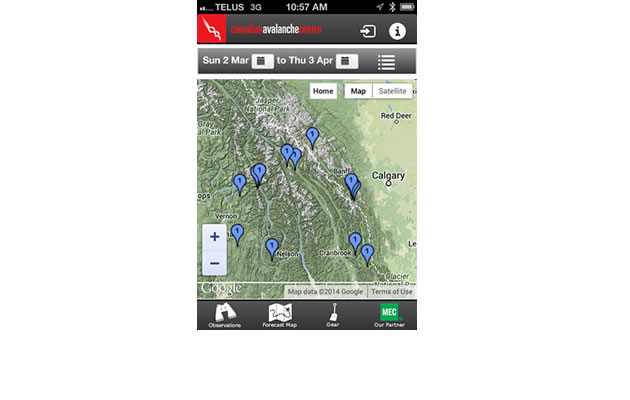
The Canadian Avalanche Centre (CAC)—with the support of Mountain Equipment Co-op and Tecterra—launched a new tool for the public this winter. It is a new feature in the CAC Avalanche Bulletin smartphone app that lets the public share photos and comments about current avalanche conditions.
“A picture is truly worth a thousand words,” said Ilya Storm, Field Programs Manager for the CAC’s public avalanche warning service. “We’re looking forward to receiving images of avalanches, precipitation, cornice build-up, wind action (and) just about anything that helps us verify our forecasts and (that) improves our understanding of local conditions.”
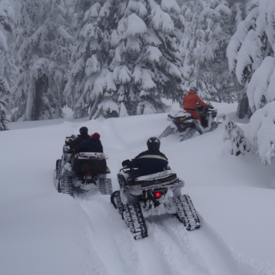
Even a photo of sled activity on a steep slope with no avalanche release is a useful observation of the current stability.
Staying safe in avalanche terrain is always about making thoughtful decisions, based on the interpretation of high quality observations gathered in a timely manner from various sources—including snowpack, weather and avalanche data from representative areas.
Whew! That was a mouthful. Let’s take a closer look, as there are a few challenging points in this last sentence.
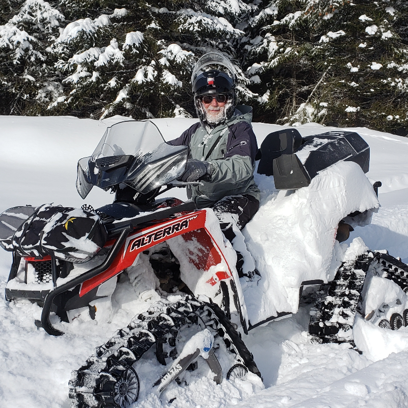
The best situation would be to fund multiple, highly-trained avalanche technicians to travel through our snowmobile areas on a regular basis, observing and reporting professionally gathered and interpreted observations and recommendations. It’s pretty obvious that a budget for this does not exist. What does exist, though, is a number of keen riders who have access to cameras and smartphones.
High quality
While professional level training and years of avalanche experience improve a rider’s ability to sift through all the potential observations in a day to choose the most relevant information to share, good information is often better than the alternative of no information.
Riders submitting photos shot in decent light from a couple of angles can give the trained eye some great data. Combine that with details such as GPS location, slope angle, elevation, aspect and approximate dimensions and the value increases even more.
Timely
Avalanche conditions can change dramatically over a day or two and, depending on the avalanche problem, even a few hours can make a difference. A picture or comment collected and shared in real time, or at least the same day, has tremendous value to forecasters and to fellow riders.
Various sources
Avalanches are like serial killers. They repeat in areas that have similar snowpack, terrain and weather characteristics. Our job is to figure out the pattern and avoid areas with the same dangerous recipe. The more data points, the better.
Representative areas
Data gathered in areas similar to where you are riding is most relevant. Since most of the data feeding into the CAC Avalanche Bulletins is currently coming from commercial ski and transportation operations, the forecasts for sledding areas are extrapolations. This is good, but even better would be for riders to be submitting sled-specific observations.
When submitting, attempt to include information such as slope angle and elevation, as well as the location’s orientation to sun and wind. Even if your mobile phone has no signal, it will still geotag your image with GPS data and correctly position it on the map when you upload it.
The Observer Network is a super economical and efficient tool for the public to quickly share observations. A picture of a recent slide is valuable, no matter whether the photographer was an amateur or a professional. On average it is better to have multiple bits of data from a variety of sources rather than a couple bits of super high-quality professional data.
If you don’t already use the CAC Avalanche Bulletin app . . . what are you waiting for? Get it downloaded into your smartphone and while you’re at it, create a new account for the Observer Network feature.
Be a part of the solution and upload your perspective of the avalanche conditions the next time you’re out riding!
Just a heads up that Zacs Tracs 2014-2015 avalanche training schedule is already posted on our website. If you haven’t taken a class in the last three years, it is time for a refresher. Staying on top of the current trends and research in avalanche education will help you stay on top of the snow.