Thanks to a unique partnership between the Crow Snow Riders snowmobiling club and the Quad Squad quadding club, trails in the Crowsnest Pass are kept clear and operational all year long. It also means that trails are both well-mapped and distinctly signed, and that the two main staging areas—one to the north of the valley and one to the south—both feature large areas for parking, and turn-around sites so that no backing of big trailers is required.
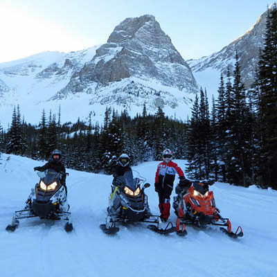
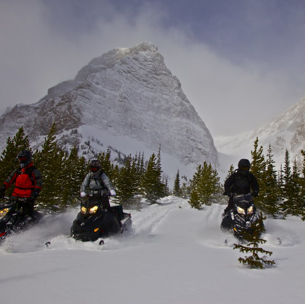
The area is a mountainous region, and because the trails are also set up for quadders, they have passes that travel north and south that parallel the Great Divide. Riders can choose to travel routes devoid of any large hills, or opt for more adventurous routes with large bowls to play in off the side of the mountains.
South Trails
Popular even amongst long-time dwellers of the Pass, the main trail heading to the South shelter down from the York Creek staging area, offers an abundance of adventurous playgrounds and stunning scenery.
From there riders can travel into an area known as Lost Lake. Entering the area you’ll drive onto the top of a saddle and look down upon the lake. While it may look at first glance like there’s no way out, in this instance, the look is simply deceiving as the trail continues on past the lake.
The site of a fire in 2003, nearly half of these trails lie in the fire zone, making them wide open with huge vistas that allow you to see right to the Divide—almost down to Waterton Park, depending on the hill you stop on—with access available all the way to the East Kootenay and the Kootenay Pass.
This is an area where many of the trails were newly built just over a year ago, thanks to a federal grant. Even amongst locals, the new trails found between Lost Lake and the MacDonald Range are considered some of the best in the area.
North Trails
The second main staging area to access northern trails can be found at the Atlas Staging Area. Located on the north half of the Valley near Coleman, access is easily found right off the highway, with signage that continues on through residential areas to ensure travellers know where they are headed.
Here the trails are also groomed weekly right up to the safety shelter found 21 kilometres away. From here riders have access to a number of different areas including Crowsnest Mountain, famous for its formations, and Window Mountain which boasts a unique limestone arch. At these great heights you will find stunning vistas.
On lower sections of the northern trails, pine and spruce trees are the norm, and offer many breakaway points from which to branch away from the main trail.